All about hiking Mount Gardner on Bowen Island. Quick facts, plus some useful shortcuts, tips and tricks that I hope you will find useful.
- Duration: 4-5 hours round trip (2.5 hours if you’re very fast)
- Distance: 10km round trip (with 700m+ elevation gain)
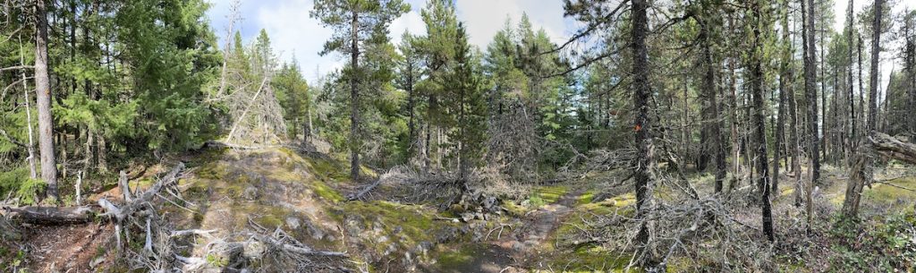
- Terrain: steep gravel with uneven patches
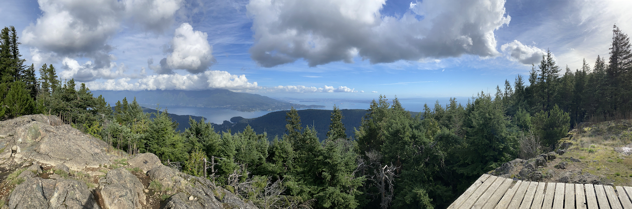
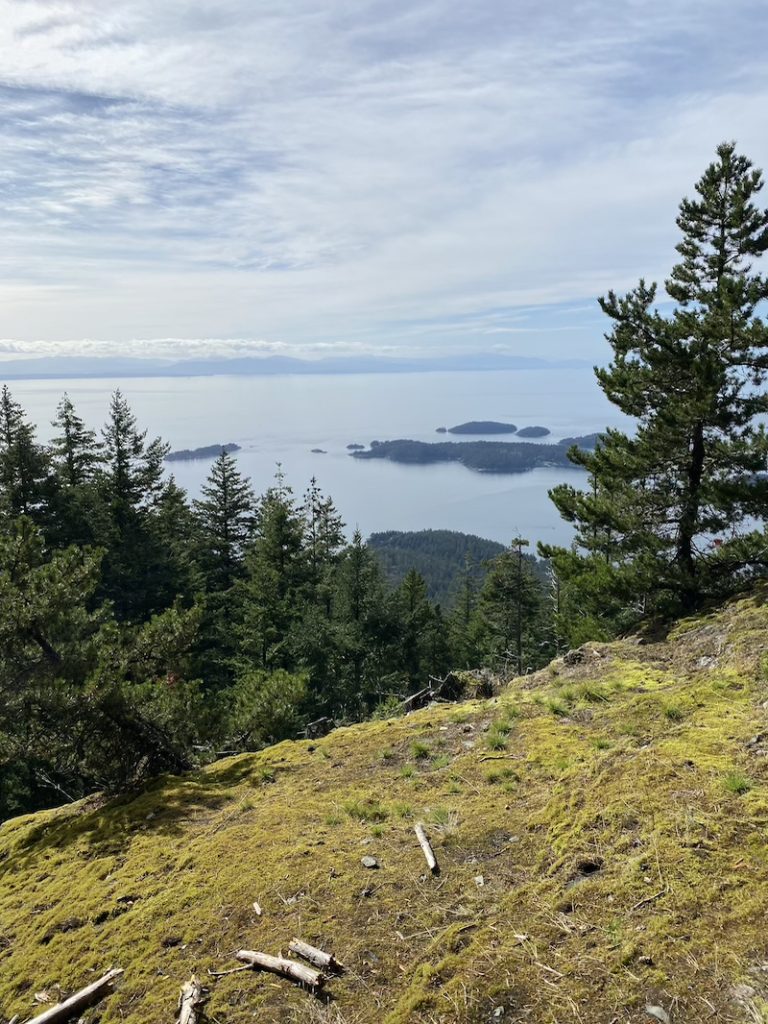
- Payoff: excellent views looking back to Vancouver, Horseshoe Bay, Sunshine Coast
- Steep Shortcuts: drive or bike to the top of Laura Road next to Rileys Cidery. Hike in and it’s 45min – 1hr 15min to the first viewpoint (not the top) and you’ll still get a great view.
- Highest Point: 720 m
- Destination: North Summit, the South Summit is covered in trees, and does not provide a view.
- Cons: A cougar is actively making the West Side their home. Pro’s: it’s well fed hunting small deer not humans. Don’t let this discourage you.
In This Article
- Alerts
- Destinations
- Starting Points
- Steep Shortcuts
- Preparing to Hike
- Cell Reception
- Supplies
- Wildlife
- Weather
- Camping
Alerts – Cougar in Area
While there is a cougar currently in the area, attacks are very rare, and have never happened to humans on Bowen Island. Keeping that in mind, the risk of being attacked is statistically lower than falling off your eBike or driving to the trailhead.
If you spot the cougar, contact the Conservation Officer at 1-877-952-7277
What to do if you encounter a cougar?
- Never Run & Keep Calm
- Pickup Children & Small Pets
- Make yourself as big as possible
- If it starts to follow you, maintain eye contact, yell and make loud noises.
- If it starts to attack you, fight back
Mount Gardner Hike
A hike to the peak of Bowen Islands Mount Gardner provides a great work-out, time to connect with BC’s nature and spectacular views of the City of Vancouver, the beautiful Howe Sound islands and the gorgeous sunshine coast. The photos just don’t do it justice.
Destinations
The majority of people are aiming for the North or South Summit. We highly recommend the North Summit as the south Summit is covered in trees.
People also hike up from the top of Laura Road for the fastest view you can get off the Mountain. So see our Steep Shortcut section for directions.
Starting Points
Skid Trail near Killarney Lake begins 3km from Snug Cove beginning the 5 hour round trip from Skid Trail: Coordinates on Google Maps.
Bowen Bay Trail Head Above Rileys Cidery: Coordinates on Google Maps.
Steep Shortcut
Are you looking for fast views, within 45min to 1hour of hiking, and don’t necessarily care about reaching the top? Well, you can drive, ebike (booking link), or bus to the top of Laura Road near Riley’s Cidery and start walking in from there to the South Ridge Express. Here you’ll head up the South side of the Mount Gardner. You’re looking for the South Ridge Express, and keep following signs that say “To Summit”.
This will take you to a fantastic viewpoint overlooking King Edward Bay. The other bonus of this route is you get the opportunity to start, or finish your hike with some delicious Cider.
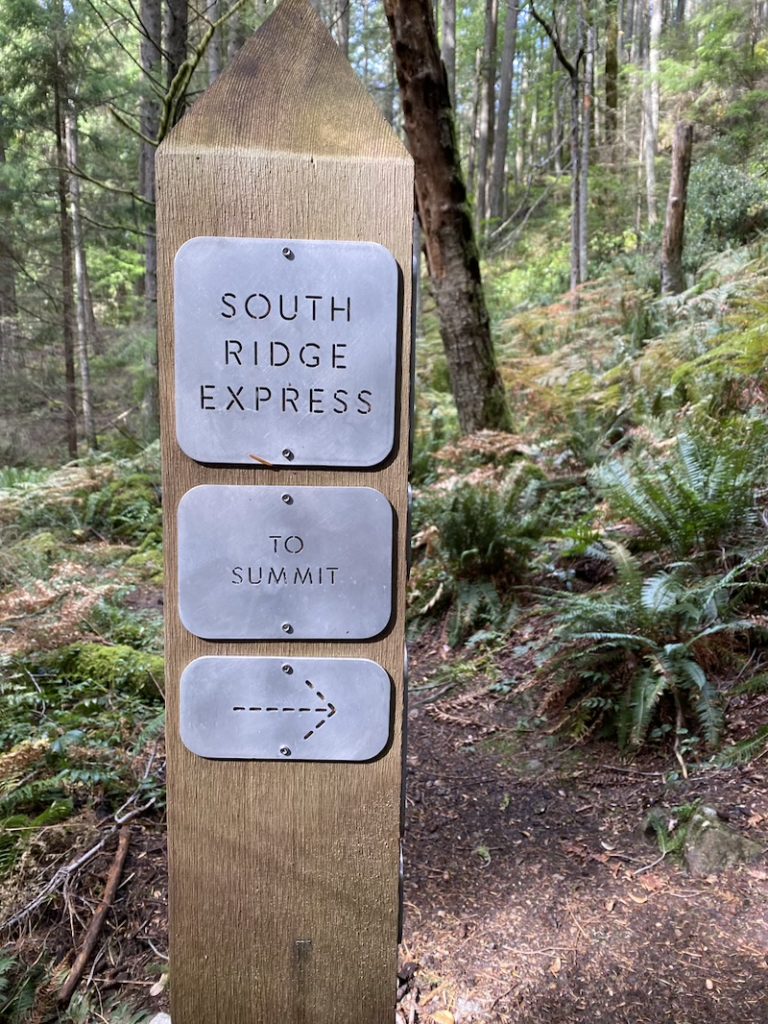
The First Signpost when entering from Laura Road on the South West Side of the Mountain.
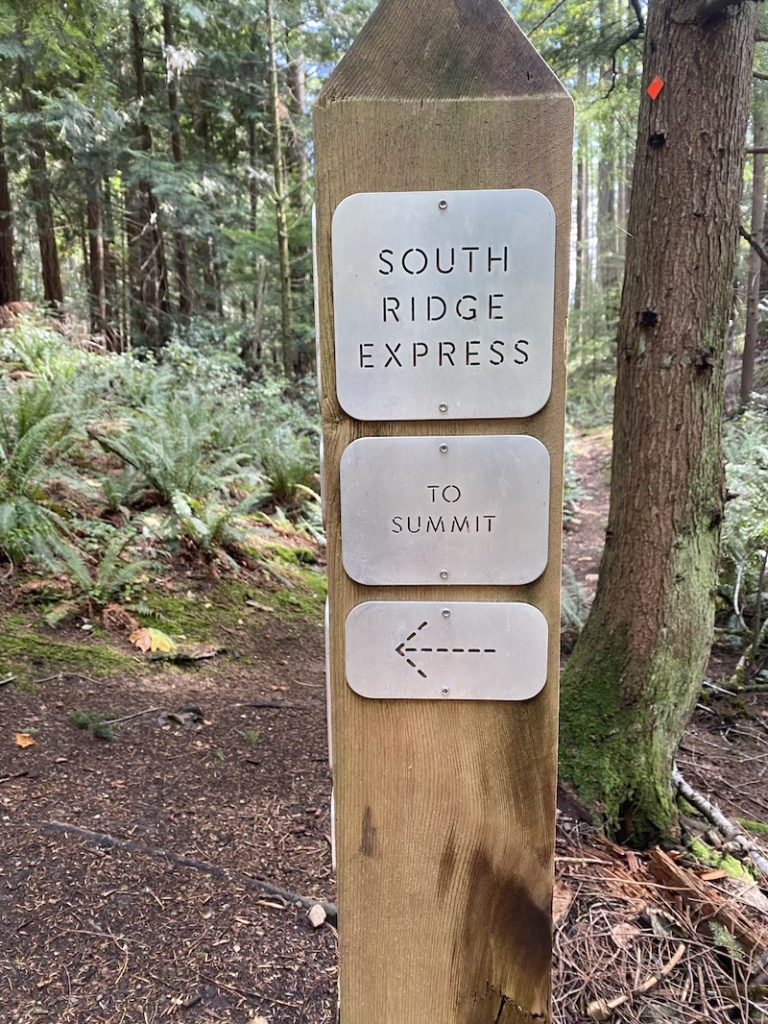
The Second Signpost you’ll see, just keep following the “To Summit” markings.
If you get lost, notice the orange tags on the trees, they will continue to guide you.
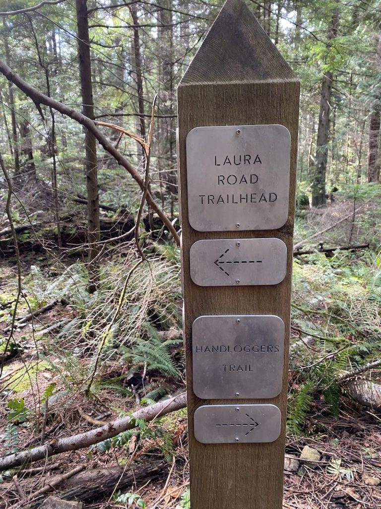
When leaving the mountain on the South Side you’re looking for Laura Road Trailhead. The Handloggers trail continues to go up the mountain a different way.
Preparing to Hike Mount Gardner
Hiking Mount Gardner on Bowen Island is the most difficult hike we have, and can take 5 hours to complete plus extra time if one gets lost or tired. Having extra water, snacks, phone battery are all important when tackling this hike.
If you’d like an easier hike, perhaps see Hiking Dorman Point on Bowen Island (Post)?
Cell Reception
There is minimal coverage on the eastern side of the mountain, and reception is generally poor near the Killarney Lake area when starting out. An offline map is recommended wether it’s physical, or digital. If you have Google Maps, see how to download for Android or iOS offline.
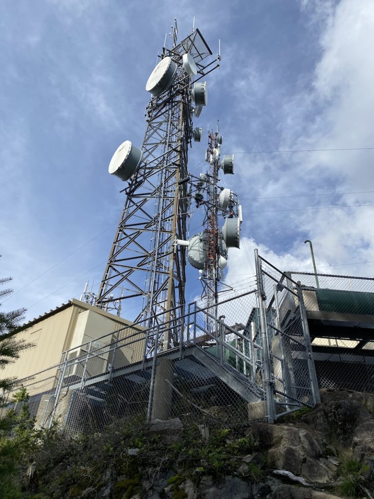
While reception is spotty heading up on the Eastern Side, there is fantastic coverage at the top of the mountain as it is home to an array of 4G and 5G towers. The Southern Side of the Mount Gardner has better coverage than the Eastern Side.
Supplies
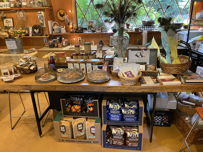
There are no water sources along Mount Gardner’s trails, other than still ponds if it’s been raining. If you haven’t prepared snacks or supplies for your hike you can easily grab food and drinks from the General Store or Ruddy Potato just a short 5 minute walk from the ferry terminal. For my trip up with these photos, I went to Alderwood Farm to grab some fresh dip and organic chips.
Wildlife
Have you seen our article on Where are the Bears on Bowen Island?
The wonderful variety of wildlife on Bowen means you may come across the large numbers of Black-tailed deer, snakes, eagles, songbirds, salmon, skunks, tree frogs, squirrels, vultures, mink, salamanders, ducks, and butterflies. Hiking on Bowen Island is generally safer by contrast than hiking in mainland BC as Bears and Cougars are rare on the island. Bears are spotted roughly once every 5 years, and cougars are even more rare.
While it is rare, there is currently a cougar on Bowen Island in for Summer and up to October 2024.
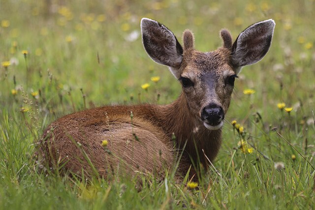
Image Credit: Buiobuione ‘Black-tailed deer – Odocoileus hemionus columbianus – 05.jpg’
Weather
Due to its somewhat low elevation Mount Gardner is a doable hike for most of the year. In mid winter through to early spring you will likely find snow at the top but otherwise this hike is generally absent of snow.
Pets on the hike
Hiking Mount Gardner on Bowen with pets is awesome, so be sure to bring your canine pals on the adventure! With the recent cougar in the area, keeping your furry friends on leash is recommended.
Camping on Mount Gardner
Unfortunately, camping is prohibited on Bowen Island. The helipads at the top are under surveillance from the cell tower buildings behind them, and RCMP have made their way up to pull campers off the pads at night.